Author Archives: Om

Home / Articles posted by Om ()

Sangla Sightseeing

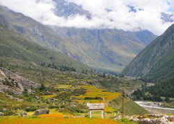
Sangla : Sangla is a city in the Baspa Valley, also referred to as the Sangla valley, in the Kinnaur District of Himachal Pradesh, India, close to the Tibetan border.

 Sangla Valley Tour
09 NIGHT / 08 DAYS
1N – Barog – 1N Rampur
2N Sangla – 2N Kalpa – 1N Fagu
Deluxe : INR 31,900
 chitkul-sangla3

#Chitkul
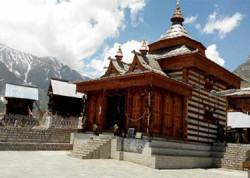
Chitkul is the last inhabited village situated near Indo-Tibet border at a distance of 20 km from Sangla. This village lies on the right bank of River Baspa. The most popular attraction of this village is the temple of local goddess ‘Chitkul Maathi’ also known as ‘Mata Devi’. People of the entire Kinnaur District come to worship at this temple. Chitkul also experiences heavy snowfall during winters, due to which it also becomes completely un-inhabited.

#Baspa River
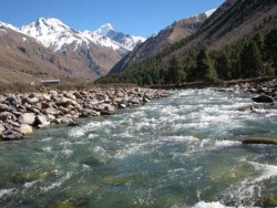
The Baspa River is a fast flowing river that passes though the hills of Sangla. The surroundings of Baspa River provide an opportunity to view timely rainbows and brown trout. It is also an angler’s paradise for being home to a vast variety of fishes. Crossing this river is also quite an attraction amongst the visitors as this process involves ride in a basket along the way. Its surrounding areas also stand appropriate for campers and trekkers.
baspa river
 kamru-fort1 #Kamru Fort
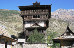
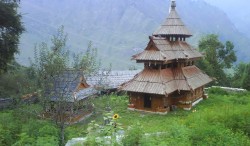
The Kamru Fort is situated at an altitude of 2600 m above the sea level at 229 km from Shimla and 2 km from the Sangla Valley. It is located in the picturesque location of the Sangla Valley and is entered through a series of gates. At the main gate of this fort is a large image of Lord Buddha that welcomes you. There is also a wooden balcony at the top of this fort along with an idol of Kamakhya Devi installed in its third floor.This idol of Kamakhya Devi is said to have been brought from Guwahati. There is also a Badrinath Temple situated within the premises of this Kamru Fort that dates back to the 15th century. There is also a popular fair held in the place to honour the main deity of the temple. During this fair, the idol of the temple is taken to Gangotri, which is the origin of River Ganges.
#Bering Nag Temple
The Bering Nag Temple is another popular nearby temple and religious sightseeing destination of Sangla. This temple is dedicated to God Jagas. Its most popular feature is the Fulaich Fair, held here every year between the months of August and September.
 bering nag temple
 buddhist-monastery-sangla2 #Buddhist Monastery
There is also a fine Buddhist Monastery situated near Sangla. This monastery lies near the Reckong Peo in Brelengi due to which it is also known as Brelengi Gompa. This monastery displays modern Buddhist edifice. It was constructed by the Mahabodhi Society in 1992 for facilitating the Dalai Lama to perform the Kalachakra ceremony. Near to this monastery is a 10 m statue of standing Buddha, visible from a considerable distance.
#Sangla Meadows
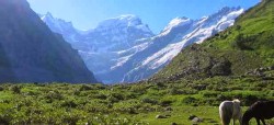
The Sangla Meadows also known as Sangla Kanda is another natural sightseeing attraction in Sangla. This place is completely covered in greenery and surrounded by snow capped mountain ranges of the Himalayas. It also forms a perfect site to see the Kinner Kailash in an 180o view. This place will also provide a view of the local huts of Himachal along with the customs and lifestyle of its local people.
sangla valley 2 sarahan-meadow
 tibetan-wood-carving-center-sangla1 #Tibetan Wood Carving Centre
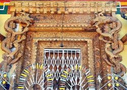
The Tibetan Wood Carving Centre is one of the most popular sightseeing destinations of Sangla. It is situated near the Saffron Farm in the outskirts of Sangla. Its main attraction are the items made out of wood carvings in Tibetan style. These items are present here for both display and sale purposes.

Sangla Sightseeing

Loading image... Loading image... Loading image... Loading image...

Kalpa Sightseeing

Kalpa – Kalpa is one of the most beautiful tourist attractions in Himachal Pradesh. Located at an elevation of around 2,758 meters above sea level, Kalpa is home to the wonderful Kinner-Kailash ranges amid picturesque Himalayan hills and serene valleys. Kalpa with its spiritual quotient and lovely natural landscape offers the best relaxation options for tourists and travelers away from the hustle and bustle of busy city life. From the rugged mountains to the lovely river banks, Kalpa is home to a number of ancient Forts and temples. The city attracts a large number of pilgrims to the famous Kinner-Kailash Mountain ranges considered holy by both Hindus and Buddhists alike.  Sangla Valley Tour
09 NIGHT / 08 DAYS
1N – Barog – 1N Rampur
2N Sangla – 2N Kalpa – 1N Fagu
Deluxe : INR 31,900
 Sapni Fort

#Sapni Fort:
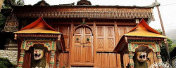
Sapni Fort located in the Sapni village near Kalpa is one of the most famous landmarks of the region. Built as a conjoint Fort by two distinct buildings, the seven stories Sapni Fort attracts a large number of historians and tourists. Woodwork on the window frames of the Sapni Fort are the unique high point of this ancient marvel. Built by Raja Padam Singh of Rampur, Sapni Fort has a Kali temple in its vicinity attracting a large number of pilgrims.

#Kamru Fort:
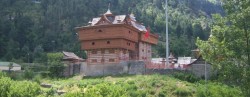
Kamru Fort located at a distance of around 2 km from Sangla Valley is one of the most ancient monuments of Kalpa region. The Fort is famous for its wood work including wooden balconies and a majestic picture of Lord Buddha at the front gate. An ancient 15th century temple dedicated to Lord Badrinath is located in the vicinity of the Kamru Fort attracting a large number of pilgrims and historians alike. Located at an elevation of 2600 meters above sea level, Kamru Fort is an epitome of ancient richness of the Himachal Kingdom in the bygone era.
kamru fort
 sangla valley #Sangla Valley:
The beautiful Sangla valley in Kalpa attracts a large number of tourists all through the year. Famous for its majestic natural landscape, the valley is set amid lovely flowing water streams and snow capped mountains making it a perfect holiday destination. Located at a distance of 8900 feet above sea level on the banks of Bapsa River, Sangla Valley is one of the most picturesque tourist attractions in Kalpa.
#Kinner Kailash:
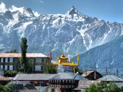
Kinner Kailash also known as Kinnaur Kailash is one of the most important religious attractions in Kalpa. Located at an altitude of 6500 meters above sea level, the peaks of Kinner Kaliash and Jorkanden are spiritual locations for Hindus and Buddhists alike. The peaks attract a large number of pilgrims and adventure tourists alike making it one of the most highly visited attractions in Kalpa.
 kinner kailash
 kothi temple #Kothi Temple:
Kothi temple dedicated to Goddess Chamunda Devi is one of the most well know religious shrines in Kalpa. Located right at the bottom of the Rohtang Pass, around 12 km from the town of Manali, the temple has a gold image of the Goddess that is kept in the main chamber. Kothi apart from its religious significance also offers majestic panoramic views of the surrounding snow capped mountains and valleys.
#Batseri:
Batseri village located on the banks of Baspa River is an important religious and trekking attraction in Kalpa. The village is reachable only on foot by passing through the lovely cantilevered logged bridge making it one of the most beautiful attractions in Kalpa. A unique form of architecture, which are locally known as kathkundi is the highpoint of Batseri village. Batseri village attracts a large number of trekking excursions all through the year.
 batseri-village4
 suicide point #Suicide Point:
Suicide Point as the name suggests is a dangerous trench with high vertical slopes. The point located near Kalpa village is dangerous and risky to be covered by foot and tourists are advised to maintain a safe distance from the deep gorge when travelling in and around the suicide point region.
#Roghi village:
Roghi village located around 8 km from Kalpa is a famous tourist destination. Known for its Apple orchids and ethnic village art and carts, Roghi village offers a peak into the cultural activity of the region along with magnificent sights of apple orchids all around.
 roghi village

kalpa Sightseeing

Loading image... Loading image... Loading image... Loading image... Loading image...

Kesari Tours – International Group Tours from Indore

Kesari Indore Office
We at Feel India have set up Kesari tours representation in 2005. We have been booking Tours for Kesari company and serving Indore Guest for the Last 16 Years.
Mrs. Megha Gupta – 9827731127, is doing all type of Visa assistance and guest tour planning for all guests of Kesari Tours.
Kesari Tours PSA Feel India has 3 locations in Indore to offer the services
110-111, Apollo Tower, 2-M.G. Road, Indore, M.P., India
Ph. : +91 731 2526294, +91 731 4286622, +91-98264-43300, +91-93021-03575
Email : indore@feelindia.org
Branch Office :
261, Orbit Mall, Near C21 Mall, A.B. Road, Indore- 452001, M.P., India
Ph: +91 731 4236622, +91 93008 28103, +91 98277 31127
Email : travel@feelindia.org
Branch Office :
LG9, Asha Tower, Near Unique Hospital, Annapurna Road, Indore- 452009 M.P. , India
Ph: +91 731 4293535, +91 89894 61447, +91 93295 42394
Email : holiday@feelindia.org
The Group holiday packages have a good variety catering to for our valued clients. We have a experience of 16 Years in the business. Our personal and caring services give u a life time holiday experience. We have a big client base of our valued clients, who travel year after year with us and like our services.
Our team consists of professionals with a personal touch to make our guest comfortable while understating and booking the tour. While on tour the guest is in direct contact with the booking person and our expert.

Areas of Operation of a Travel agent and Travel Agency

Khajjiar Sightseeing

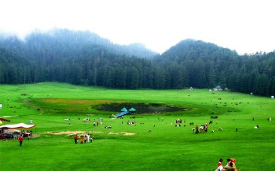
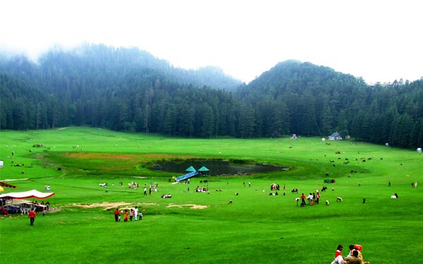
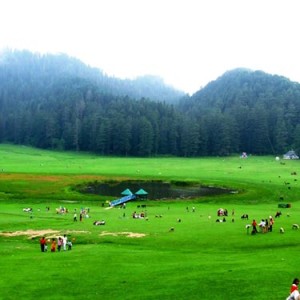
Khajjiar – Khajjiar is a popular hill station about 26 km from Dalhousie in Himachal Pradesh. Vast expanse of green meadows and dense forests besides vistas of majestic snow-clad Himalayan peaks make Khajjiar a popular destination among tourists. The Khajjiar Lake and Chamera Lake add to the charm of Khajjiar. Khajjiar is also called the Gulmarg of Himachal Pradesh and serves as the starting point for treks to Chamba, Dalhousie and Kalatop Wildlife Sanctuary among others. Indeed, trekking is the best way to explore Khajjiar. Zorbing, which involves rolling downhill from inside a plastic ‘zorb’, is a popular recreational activity during April and May.
Khajjiar lake #The Khajjiar Lake And Ground
The Khajjiar Lake and Ground can be reached via the Bakrota Hills from Dalhousie. On the way to the Kalatop Khajjiar Sanctuary, one can see the Lakkad Mandi and further down, the Khajjiar ground with the lake located centrally in it. This spot is ideal for photography and has also featured in lots of movies. The lake is considered holy due to its long association with the idol of the Khajji Nag Temple. This perennial lake is fed by a number of tiny water streams. On the lake, some clusters of grasses and weeds have grown that appear like a floating island, and is the major attraction. The spot around the lake, situated at an elevation of 1950 m above sea level, is a popular picnicking area.
#Panch Pandav Tree
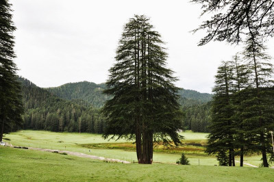
The Panch Pandav Tree is situated in the ground of Khajjiar. The tree is famous for its shoots. Although the main root of the tree and the shoots are same, there are six shoots branching out from the tree.According to the local inhabitants, the five shoots of this tree stand for the Five Pandavas and the last one symbolises Draupadi. This tree is close to a rest house that leads the way to Khajjiar School and a small village.In the forest of Khajjiar, trees having many shoots are a common sight. There is one deodar tree that stands a kilometre away from Khajjiar on the way to Dalhousie. It has 13 shoots of standard height. The tree has acquired the name of “Mother Tree” of the entire region.
Panch_Pandav_Tree_Khajjiar
golden-devi-temple-khajjair #The Golden Devi Temple
The Golden Devi Temple in Khajjiar is named due to the golden dome of the temple. Located on the edge of the Khajjiar Lake, the temple’s golden spire is a major attraction. Close to this temple, there is a golf course that also draws a lot of people.
#Khalatop Wildlife Sanctuary
The Khalatop Wildlife Sanctuary is situated amidst oak and coniferous trees. Stretched over an area of about 19.63 sq km, this sanctuary is home to species like deer, serow, jackal, leopard, black bear, wild cats, Himalayan black marten and others. Many endangered species of animals and birds can be seen here as well. This sanctuary lies within the stretch between Dalhousie and Khajjiar.
kalatop-wildlife-sanctuary-1
khajji-nag-temple3 #Khajji Nag Temple
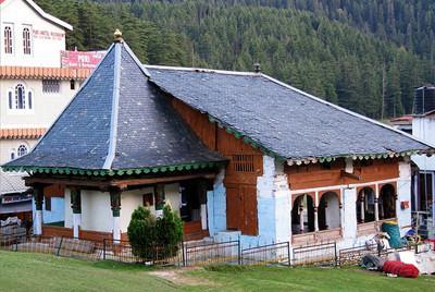
This temple is dedicated to Khajji Nag, who is the Lord of the Serpents.Inside the temple, there is a mandapa where visitors can view hanging images of the Pandavas along with the defeated Kauravas from the roof of this temple, appearing in a roundabout way. The chambers of this temple are carved out of wood. The construction of this temple began in the 10th century AD and is reflected in the architecture of the temple that exhibits a mix of Hindu and Muslim style. Located in the district of Chamba, this temple is considered significant and is visited by pilgrims regularly. The interiors of this temple have idols of Lord Shiva along with Goddess Hadimba.

Khajjiar Sightseeing

Loading image... Loading image... Loading image... Loading image...

Punakha Sightseeing

Punakha : Punakha served as the capital of Bhutan until and still it is the winter seat of Je-Khenpo (the chief abbot). Blessed with temperate climate and owing to its natural drainage from Pho Chhu (male) and Mo Chhu (female) rivers, the Punakha valley produces abundant crops and fruits. There are splendid views of the distant Himalayas at Dochula pas on Thimphu – Punakha road.

 PunakhaDzongInSpring

#Punakha Dzong
Built strategically at Thimphu town the junction of Pho Chhu and Mo Chhu rivers in 1637, by Shabdrung Ngawang Namgyal
to serve as the religious and administrative centre of the region, Punakha Dzong has played an important role in Bhutan’s history. Damaged by four catastrophic fires and an earthquake, the Dzong has been fully restored by the present King. The Dzong is open for visitors during Punakha festival and in summer months when the monk body moves to Thimphu.

#Chimi Lhakhang
The Chimi Lhakhang, situated on a hillock in the centre of the valley, is dedicated to Lama Drukpa Kuenley, who in the late 15th century used humour, songs and outrageous behavior to dramatise his teachings and due to this also known as “Divine Madman”.
This temple is also known as the temple of fertility. It is widely believed that couples who do not have children and wanting one, if they pray at this temple, they are usually blessed with a child very soon. It is about 30 minute walk across field from the road to the temple. The trail leads across rice fields to the tiny settlement of Pana, meaning “field”. It then follows a tiny stream downhill to Yoaka and across more fields before making a short climb to Chimi Lhakhang.

Chimi-Lhakhang
 Khamsum Yulley Namgyal Chorten #Khamsum Yulley Namgyal Chorten
A beautiful hike takes one to the regal Khamsum Yuelley Namgel Chorten, which was built to remove negative forces and promote peace, stability and harmony in the changing world.
The Chorten dominates the upper Punakha Valley with commanding views across the Mo Chhu and up towards the mountainous peaks of Gasa and beyond.


#Sangchhen Dorji Lhuendrup Lhakhang Nunnery
Perched on a ridge amid pine trees and overlooking valleys of Punakha and Wangduephodrang, gleams the magnificent structures of Sangchhen Dorji Lhuendrup Lhakhang(Temple). The temple houses a 14-foot main bronze statue of Avalokiteshvara (Chenrigzig chagtong chentong). Other statues include those of Guru Padmasambawa, Gautama Buddha, Zhabdrung Ngawang Namgyel, Tsela Namsum, the 21 Taras and Tsepamay (Buddha of longevity). The Avalokiteshvara statue, one of the biggest in the country, was the handiwork of entirely local Bhutanese artisans. The temple complex also houses a permanent higher learning and meditation centre for nuns where, apart from religious trainings, it provides life skill training such as tailoring, embroidery, statue making and thangka painting.

 Sangchhen Dorji Lhuendrup Lhakhang Nunnery
 talo #Talo
The village of Talo (alt. 2,800m) which is scattered along the hill slopes, known for its cleanliness and hygiene among Punakha villages. 
Talo Sangnacholing is built on a plateau and has majestic view of surrounding villages. The beautiful farm houses of the village have its own flower gardens and on the hill slope corns and sweet peas are grown in abundance. The women of Talo are particular known for their beauty.
#Punakha Ritsha Village
Bhutan’s Punakha valley is famous for rice farming where both red and white rice are grown along the river valleys of Pho and Mo Chhu, two of the most prominent rivers in Bhutan. ‘Ritsha’ meaning ‘at the base of a hill’ is a typical village in Punakha. The village houses are made of pounded mud with stone foundations. Each house is only two storey high surrounded with gardens and the rice fields. The gardens also usually have fruit bearing plants like oranges and papaya among the organic vegetables. In the recent years, the farming work is mechanized and power-tillers instead of bullocks are used to plough the fields and villagers have become relatively prosperous. This is a model rice growing village in western Bhutan.
 rinchengang-village

Punakha Sightseeing

Loading image... Loading image... Loading image... Loading image...

Phuentsholing Sightseeing

Phuentsholing – The frontier town, it is a thriving commercial centre, situated directly at the base of Himalayan foothills. It is a fascinating place where different ethnic groups mingle prominently Indian, Bhutanese and Nepalese. Being the border town, Phuentsholing serves as the convenient entry/exit point for Bhutan and also the important link to visit the Indian state of West Bengal, Sikkim and Assam.

 visitphuentsholing lhakhang at phuentsholing

#Zangtho Pelri Lhakhang
Situated in city centre, this small temple represents the heaven of Guru Rinpoche. On ground floor there are statues of eight manifestations of Guru Rinpoche and paintings on Buddha’s life while the next floor contains eight Bodhisattavas and statues of Avalokiteshvara and Shabdrung Ngawang Namgyal. On top floor, there is a main statue of Amitabha.

#Kharbandi Goemba
Founded in 1967 by Royal Grand Mother, Ashi Phuntsho Choedron and situated at the altitude of 400m, this beautiful monastery contains paintings on the life of Buddha, statues of Shabdrung Ngawang Namgyal and Guru Rinpoche. From the monastery garden there is a fascinating view of Phuentsholing town and surrounding plains.
kharbandi goemba

Phuentsholing Sightseeing

Loading image... Loading image...

Thimphu Sightseeing

Thimphu : Thimphu formerly spelled Thimbu,is the capital and largest city of Bhutan.It is situated in the western central part of Bhutan and the surrounding valley is one of Bhutan’s dzongkhags, the Thimphu District. The city became the capital of Bhutan in 1961. It has a population of 91,000, as of 2011.The city is spread out laterally in a north-south direction on the west bank of the valley formed by the Raid k River, which is known as the Wang Chuu or Thimphu Chuu in Bhutan. Thimphu is spread over an altitudinal range between 2,248 metres (7,375 feet) and 2,648 metres (8,688 feet).Unusually for a capital city, Thimphu is not served by an airport, but relies on the Paro Airport.

 thimphu-dzong

#Visit the Dzong
The sprawling
Tashichho Dzong with its golden-red roofs is the fortress-monastery that is the seat of government offices, the headquarters of the monks and also houses the throne room and offices of the king. The Dzong was originally built in the 17th century but destroyed by fire and earthquakes multiple times and rebuilt.  Make sure that you visit it after 5pm to get a glimpse into its rich woodwork and mandala paintings.

#Hit the bulls eye
Archery is the country’s national sport and if you are in the capital over the weekend, you can catch an archery tournament at the Changlimithang Archery Ground,
where traditional bamboo has been increasingly replaced by hi- tech carbon bows. Enjoy the impromptu song and slow motion dance as well as the verbal exchanges and combat that the teams break into when someone hit’s the bull’s eye or misses the mark.
hit bull eye
 changangkha temple #Changangkha Lhakhang
Situated on a small hill overlooking the Thimphu valley the monastery was built in the 13th century by Lam Phajo Dugom Zhigpo. Children born in Thimphu are taken to this temple because it is considered the spiritual home of the children born in Chang valley.Names such as Tandin and Sonam are given from this temple to new born babies taken for blessings from the protector deity Tamdrin.The central statue in the temple is Avaloketesvara, Buddha of compassion, in his manifestation with 11 heads, a thousand hands and eyes; it is built with bronze and plated with gold.

#Dechen Phodrang
At the end of Gaden Lam is the Dechen Phodrang, the site of Thimphu’s original dzong.
Since 1971 it has been the state monastic school, where an eight-year course to almost 500 monk students is provided. The 12 century paintings in the monastery’s Guru Lhakhang have been restored and the upper floor features a large figure of Zhabdrung Ngawang Namgyal as well as a goenkhang (chapel dedicated to protective deities and only men are allowed inside it). Dechen Phodrang literally means palace of the great bliss.
 dechen phodrang
 Dochula #Dochula
Marked by an array of prayer flags & 108 chortens, “The Dochula pass” is at an altitude of 3,050 meters above sea-level and it is the first high pass in the western region which is 23 kilometers from Thimphu on the way to Punakha. On a clear day a panoramic view of the Bhutanese Himalayas can be seen from here. The 108 chortens and the Druk Wangyel Lhakhang, built by Queen Mother Dorji Wangmo Wangchuck to honor His Majesty the Fourth King in 2003, are some of the main attractions there. The Druk Wangyal Chorten stands on the crest of Dochula overlooking the unique spiral of 108 chortens. More than half an hour drive will take you there.
#Institute for Zorig Chusum
Also known as the painting school, the institute has students learning the 13 traditional arts and crafts of Bhutan.
The institute offers an eight-year course in the techniques of traditional art in 13 traditional arts such as painting, woodcarving, clay sculpture, mask making and so on. The institute also teaches traditional thangkha painting and a few foreigners come to Bhutan to learn the art. The institute has a showroom where works of students are sold at reasonable price.
 institute for zorig
 kuensel phodrang #Kuensel Phodrang (Buddha Point)
It is one of the most happening points in Thimphu. It is locally named Buddha Point but the actual name is Kuensel Phodrang. It is called the Buddha point because the largest statue of Buddha in the country sits there. The 51.5 meter bronze statue is three storied with several chapels. The body of Buddha is filled with 125000 smaller statues of Buddha. The well paved road leading to the Buddha is mostly used for drives, cycling, jogging and walk apart from those who go there to pay homage to Buddha. The night view of Thimphu from this point is ravishing and magical.
#National Institute of Traditional Medicine
The National Institute of Traditional Medicine is a training centre for medical practitioners. Herbal medicines are prepared and dispensed here. Bhutan has rich tradition of medicine based on natural remedies derived mainly from plants, earth and some animals. The institute collects medicinal plants from remote corners of Bhutan’s Himalayan region such as Lingzhi, Laya and Lunana. The institute has facility for outpatients, training, research and production of traditional medicines. The institute also has an exhibition room. The institute was established in 1978.
 national institute of traditional medicine
 stamp heaven #Stamp heaven
Bhutan is a philatelist’s dream with round, square, rectangular, triangular and even 3D stamps with different series devoted to different objects and events. Visit the philately counter at the National Post Office at Chang Lam to buy some local stamps as gifts.  For a unique souvenir, buy a personalised stamp with your picture on it.

Thimphu Sightseeing

Loading image... Loading image... Loading image... Loading image...

Neil Island Sightseeing
Neil Island : Neil is a tiny but beautiful island located 37 Kms. to the south of the Andaman Islands. With unexplored coral reefs, brilliant bio-diversity, white sandy beaches and tropical forest and vegetation, it is one of the hot tourist spots in the Andamans. Neil Island is known as the ‘vegetable bowl’ of the Andamans. The settlers named the beaches after mythical characters of the epic Ramayana (Bharatpur, Laxmanpur, Sitapur, Ramnagar etc.) The island, with its very relaxed vibes and long, deserted beaches is a place to chill out after the “bustle” of Havelock. The widest part of the island is about 5 km in length. You can walk the whole island in about two hours.

 neil-island-jetty

#Neil Island Jetty
As you disembark from the boat at Neil Island Jetty and walk towards the market village of Neil Kendra, the beach appears before you is in the form of a long arc. Neil Kendra, a gently curving bay of white sand, straddles the jetty, scattered with picturesque wooden fishing boats. Neil Kendra is the heart of the island. On the left side of the jetty is Bharatpur Beach and on the right Laxmanpur Beach.

#Lakshmanpur Beach
The secluded beach of Lakshmanpur lies 2 km north of the Neil jetty. The beach is a broad spur of white shell sand with shallow water and offers a good snorkeling option. Sunbathing and swimming are other activities. One can view spectacular sun-set from this beach. This rocky beach lies about two kilometers from the jetty with lots of coral formation , ornamental fish, sea urchins,sea cucumbers, star fish etc. which are best suited for people of scientific temperament. The rocky surface can get slippery and one needs to be on ones guard. The main attraction here is the natural rock formations.
Laxmanpur-Beach-Neil-Island
 Bharatpur-beach #Bharatpur Beach
Bharatpur is one of the best beaches known for swimming and coral-watching with a vast sandy stretch.
This beach is ideally recommended for youngsters because of activity options. One can hire glass-bottom boats for coral viewing. The Sea around the Jetty area is full of corals with schools of fish swimming around. The colour and form of vegetation along the beach soothes the senses.
#Sitapur Beach
This beach is exposed to the open sea and thus prone to higher tides. It is 5 kilometers to the south and at the tip of the island. This beach is best suited to watch the sunrise with an impressive backdrop of natural vegetation and limestone formations. The journey from the Jetty to Sitapur beach itself is refreshing with green fields and a variety of crops and forest trees.
 sitapur-beach
 sir-huge-rose-island-2 #Sir Hugh Rose Island
This tiny island is located at the southern tip of Neil Island and is locally known as ‘Chhota’ Neil (‘Small’ Neil). This island has been declared a wild life sanctuary and is a turtle-nesting ground. Individuals have to obtain permission from the Deputy Range Officer, Forest Department at Neil Island to visit this island. Only day visits are permitted.
#Natural Rock Formation
A natural rock formation in Laxmanpur beach is locally known as the Howrah Bridge. Visit the place during low tide as the retreating sea leaves behind many a secret from its treasure trove.
 Howrah Bridge

Neil Island Sightseeing
Loading image... Loading image... Loading image... Loading image...

Havelock Island Sightseeing

Havelock Island : Havelock is one of the most important tourism destinations of the Union Territory of Andaman & Nicobar. It is one of the few islands that is inhabited, although most of it is a natural paradise, replete with white sand beaches, coral reefs with a colourful array of aquatic life, palm trees, as well as dense forests in the interiors. Inhabited mainly by Bengali settlers, the island houses a number of small villages. Covering an area of 100 sq. km, it lies on the northeast of Port Blair, 54 km by road and 33.5 km by sea. The pristine island is a great base from which to hike, fish, kayak and sail to other islands. It also offers some brilliant snorkelling and diving opportunities. Radha Nagar beach on Havelock has been voted Best Beach of Asia.

 radhanagar-beach

#Radhanagar Beach
Radhanagar Beach, also known as beach #7, is the most beautiful beach of Havelock Island.
The beach is located at a distance of 7 km from Dolphin Yatri Niwas. Radhanagar beach is rated as Asia’s best beach and has also positioned itself in world’s top ten beaches.
It is known to be one of the best places for nature lovers as it offers a wide range of flora and fauna. In addition, tourists travelling to the beach can enjoy activities like snorkelling, kayaking, scuba diving and swimming. Elephant rides along with beautiful views of sunsets can also be enjoyed at this beach.

#Elephant Beach
Elephant Beach, located at a distance of around 10 km from the market, is one of the most popular beaches in Havelock Island for day trips. Reaching this beach is a hassle free affair as it is accessible either by 30 minutes hike on a jungle path or by opting for one hour boat ride. Known for its beautiful corals and exotic marine life, this beach is ideal for snorkelling. The shoreline of the Elephant Beach was largely swept by the Tsunami that occurred in 2004. At present, the existing beach is a fraction of what it used to be.
elephantbeach
 ocean-tribe-scuba-diving #Ocean Tribe Scuba Diving
Ocean Tribe Scuba diving is a diving facility recognized by PADI (Professional Association of Diving Instructors) located in Havelock Island.
With temperature of the water around 28 degrees, beginners as well as professional divers can enjoy scuba diving in the waters. Even those who cannot swim can also enjoy scuba diving by enrolling at the Ocean Tribe Scuba diving center. This dive center provides a guide and equipment needed for the diving trip.
Divers can enjoy the sight of amazing varieties of marine life such as fishes, turtles, dolphins and corals. Apart from scuba diving tourists can enjoy other activities such as snorkeling and ocean walking.
#Vijaynagar Beach
Vijaynagar Beach, also known as beach #5, is popularly known for relaxing and refreshing environment.
In addition, tourists visiting this beach can float in the natural sea salts and can also enjoy the beautiful surroundings as well. However, this beach is believed to be an undeveloped paradise, where tourists can enjoy long and peaceful walk along the beach.
 vijay nagar beach
 kalapathar-beach-in-havelock #Kalapathar Beach
Kalapathar beach is quiet a questionable beach for some because of it being pretty far from the main town, but the reason it was chosen for its mention was because of it being an amazing picnic spot to visit either alone or with friends.
Cook your own food, and enjoy your afternoon with drinks and music. As the beach’s name suggests, black colored rocks line the coastline here, there’s a forest on one side of the road, and once you cross it, you reach the heavenly and silvery beach where you might get engulfed by the sheer solitude of the calm and relaxing environment. A brilliant place to sit by and start writing some great travel stories.

Havelock Island Sightseeing

Loading image... Loading image... Loading image... Loading image...

Andaman & Nicobar Packages

Port Blair Sightseeing

Port Blair : Port Blair is the capital city of Andaman and Nicobar Island. It is the largest city of the Union Territory as well and located on the east coast of south Andaman Island. The city is named after the Lieutenant Archibald Blair who established a colony here in the year 1789. The city is undoubtedly one of the most beautiful places of this exotic island. Remarkable for its clean and serene beauty, Port Blair is visited by thousands of tourist from all over the world. This wonderful place is treasure house of marine life thriving on its wide starched coastal beaches. Known for famous beaches and eye catching vistas, this place is heaven for travelers.

 
cellular_jail

#Cellular Jail
During the British occupation of India, the prisoners were sent to Cellular Jail, to keep them far off from the revolution.
Once in these places, it was very difficult to get out and this led to the death of a number of prisoners. After a brief occupation by the Japanese forces during World War II, the town of Port Blair became the base of the Azad Hind Fauj. The execution rooms, the cells, the torture rooms and different areas of the jail are open for public viewing.
Presently, there are no prisoners and the jail is open to visitors. Inside the compound of the Cellular Jail a well maintained, beautiful garden has been created. There is a light and sound show every day at 5 pm in Hindi and 6 pm in English.

#Ross Island
Ross Island is a popular tourist spot with remnants of the Victorian British era. Some of the remains of British era that can be seen in the island include old buildings like the chief commissioners house, Presbyterian Church, state ball room, an old Andamanese home bakery, swimming pool and a hospital. A museum in Ross Island, maintained by Indian Navy, has a collection of pictures depicting the island in its full glory. Currently, the entire island is being maintained by Indian Navy. The Island is open for visitors from 8.30 am to 4.30 pm on all days except Wednesday. An entry fee of INR 20 is collected. Ross Island is an ideal place for those who want to learn about the history of British occupied India and their activities in this region.
ross-island
 chidiya-tapu #Chidiya Tapu
Chidiya Tapu is a tiny village in the southernmost tip of South Andaman. It is also known as the bird island. The region has a number of green mangroves and a lush forest cover. Birds are the major attraction here. There is a forest guest house at the top of the hillock that provides sunset views as well as views of the islands beyond Chidiya Tapu. The water in this area is full of colourful corals which makes it suitable for snorkelling.
#Corbyn’s Cove
Corbyn’s Cove is situated near Port Blair and attracts tourists for its soft sandy beach with coconut palms.
It is an ideal spot for swimming, scuba diving and boating and also for watching the sunset. During the Japanese occupation of
Corbyn’s Cove, pill boxes and bunkers were made which can be still seen on the beach. A major part of the beach was washed away and destroyed in the tsunami of 2004.
 -corbyn-s-cove-beach
 Inside_the_Anthropological_Museum_of_Andaman

#Anthropological Museum
The Anthropological Museum is one of the most visited places in town. It is maintained by the Anthropological Survey of India.
The museum illustrates the tribal life and culture. It has an exhibition of the tools and weapons that are used by the tribes as well as photographs showing the different tribes, existing and extinct. There are also items and collections showing the history of the island archipelago, a library with books of different types and by various authors who have written widely on the Union Territory. Sometimes, the museum also organises documentaries and short films showing the life of the tribes and the different social customs and cultures of the Union Territory.


#Andaman Water Sports Complex
The Andaman Water Sports Complex, also known as the Rajiv Gandhi Water Sports Complex, is located close to the Cellular Jail in the north-west part of Port Blair. The sports complex offers a range of water sports facilities and adventures. Activities like sail boating, parasailing, paddle boating, water scooters, rowing, water skiing, etc. are possible in the water sports complex.
Besides the water activities for all age groups, the monument commemorating the Battle of Aberdeen can be seen within the complex structures. The artificial waterfall in the region is also another attraction. There is a children’s park
nearby.

 andaman-water-sports
 Gandhi Park #Gandhi Park
Gandhi Park in Port Blair is a small and beautiful park with amusement rides, a garden, a small narrow trail around a small lake inside the premises, water sports, historic remains of a Japanese temple and a war bunker.
The Gandhi Park was built in only 13 days around the Delthamani tank which served as Port Blair’s only source of drinking water in those days. This park is a good source of entertainment, especially for children.
#Jolly Buoy Island
Jolly Buoy Island is situated in South Andaman Island. Located very close to Wandoor, Jolly Buoy Island is part of the famous Mahatma Gandhi Marine National Park along with a few other islands. Jolly Buoy Island is one of the prime tourist destinations in Andaman and Nicobar as the varied landscape includes mangrove swamps, tropical rainforests, pristine white sandy beaches, and coral reefs.The main activities one can experience at Jolly Buoy Island are snorkelling and scuba diving. Boat trips can also be organized into the sea for dolphin spotting and fishing.One can also visit Wandoor or the nearby Red Skin Island while at Jolly Buoy Island.
Jolly-Buoy-Island
 samudrika museum  #Samudrika Marine Museum
Samudrika Marine Museum in Port Blair, managed by the Indian Navy, is also known as Naval Marine Museum.This museum is a perfect place to know about the various aspects of marine ecology. The five galleries found here are divided based on the history of Andaman Island, geographical information, tribal communities, archeology and marine life. The main attraction of the museum is the large skeleton display of a blue whale. The museum gives information about the various aspects of coral and marine life in lay man’s language. One of the best aquariums is maintained here with an extensive collection of fishes on display. You will also find informative displays on the islands’ tribal communities.
#Mount Harriet
Mount Harriet is a 365 metres high peak in the South Andamans and is the highest in the area. With beautiful views from the hill top, it served as the summer headquarters of the chief commissioner during the British rule. There is a nature trail from this hill to the Madhuban forest. From this place, one can view the Indian Ocean and the other islands.
-mount-harriet

Port Blair Sightseeing

Loading image... Loading image... Loading image... Loading image... Loading image...